Selection of suitable sites is an essential part of planning and conducting a sustainable and efficient MAR project.
Suitability mapping for MAR sites
MAR application is generally driven by two factors: a suitable aquifer and an available water source. Local conditions, e.g. geology, soil type and terrain conditions, determine which MAR techniques can be applied for a specific location. GIS-Based Multi-Criteria Decision Analysis (GIS-MCDA) provides a frequently applied option for combining geographical/spatial data pertaining to the area intended for recharge (Malczewski and Rinner, 2015). GIS is capable of developing information in different thematic layers and is integrating them with sufficient accuracy and within a short period of time. The information obtained from analysis can serve as a basis for decision making as to where to undertake and the technique to apply for aquifer recharge and subsequent recovery. Method and site selection cannot be regarded independently!
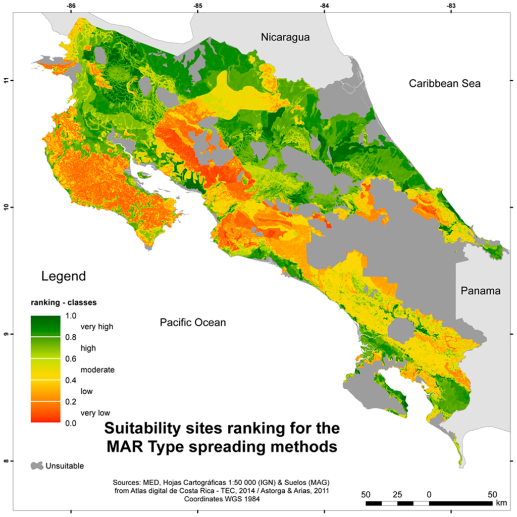
GIS-MCDA for the identification of MAR suitable sites has been applied to entire countries such as Australia (Hostetler, 2007), Spain (Fernández Escalante et al., 2014), South Africa (DWA, 2009) or Costa Rica (Bonilla et al., 2016). Most studies, however, have been conducted at scale of a local watershed and were primarily located in areas of arid or semi-arid climate conditions, such as in India (Chowdhury et al., 2010; Shankar et al., 2009), Iran (Ghayoumian et al., 2007; Mehrabi et al., 2012), Jordan (Alraggad and Jasem, 2010) or Tunisia (Chenini and Ben Mammou, 2010; Kallali et al., 2007). Aim of the studies was the generation of an overview about suitable MAR sites for water managers in order to conduct a pro-active identification of areas with potential for MAR and thus integrated water resources management strategies. For Spain an economic assessment of the suitable sites which were determined through MCDA was further conducted via GIS to investigate the economic impact of MAR application (Fernández Escalante et al., 2014).
The tools at hand provide the user with a step-by-step guide on how to conduct a MCDA including Raster handeling and smaller calculation tools for weight assignment or standartization. The process of MCDA for site selection follows the scheme developed in (Rahman et al., 2012) and is divided into:
- problem definition,
- screening of feasible areas,
- suitability mapping – including the classification of thematic layers or criteria, standardization, weighting of the criteria and layers overlaying,
- sensitivity analysis.
Furthermore, the tools provides some historical background on the use of GIS-MCDA in the context of MAR site selection. A literature review was conducted compiling studies on this topic (Sallwey et al., 2018). The results of the assessment of said studies are presented in a database and a query tool to aid the user in the decision on which criteria to use, how to standardize the selected criteria and which weights to assign during the combination.
MAR location optimization
While suitability mapping for MAR sites guides the user through the processes of identifying suitable sites for different MAR methods, the location optimization goes a step further into the localization of a specific position for the MAR system to be applied. Within a suitable MAR site it can make a big difference where the wells or infiltrations basins are located, depending on the effect the user wants to achieve by infiltrating water into the aquifer.
The use of numerical modeling to identifying the optimal number and arrangement of injection and recovery wells for a proposed ASTR site in Australia has been conducted by (Pavelic et al., 2006, 2004). The number of wells needed, well spacing, pumping and injection rates were determined by (Herrmann, 2006) for large ASR well fields in unconfined aquifers in the Middle East by numerical modeling.
Thus, the INOWAS DSS offers further assistance in the positioning of MAR structures by numerical modeling. The following INOWAS tools can be used for suitability mapping and MAR location optimization:
To select a suitable MAR method or a model set for the specific study area, the following tools can be used:
- T04. Database for GIS-based suitability mapping
- T06. MAR method selection
- T11. MAR model selection
- T17. Global MAR Portal
REFERENCES
- Alraggad, M., Jasem, H., 2010. Managed Aquifer Recharge (MAR) through Surface Infiltration in the Azraq Basin / Jordan. J. Water Resour. Prot. 02, 1057–1070. doi:10.4236/jwarp.2010.212125
- Bonilla, J., Blank, C., Roidt, M., Schneider, L., Stefan, C., 2016. Application of a GIS Multi-Criteria Decision Analysis for the Identification of Intrinsic Suitable Sites in Costa Rica for the Application of Managed Aquifer Recharge (MAR) through Spreading Methods. Water 8, 391. doi:10.3390/w8090391
- Chenini, I., Ben Mammou, A., 2010. Groundwater recharge study in arid region: An approach using GIS techniques and numerical modeling. Comput. Geosci. 36, 801–817. doi:10.1016/j.cageo.2009.06.014
- Chowdhury, A., Jha, M.K., Chowdary, V.M., 2010. Delineation of groundwater recharge zones and identification of artificial recharge sites in West Medinipur district, West Bengal, using RS, GIS and MCDM techniques. Environ. Earth Sci. 59, 1209–1222. doi:10.1007/s12665-009-0110-9
- DWA, 2009. Potential Artificial Recharge Areas in South Africa (No. PRSA 000/00/11609/1), Strategy and Guideline Development for National Groundwater Planning Requirements.
- Fernández Escalante, E., Calero Gil, R., San Miguel Fraile, M.Á., Sánchez Serrano, F., 2014. Economic Assessment of Opportunities for Managed Aquifer Recharge Techniques in Spain Using an Advanced Geographic Information System (GIS). Water 6, 2021–2040. doi:10.3390/w6072021
- Ghayoumian, J., Mohseni Saravi, M., Feiznia, S., Nouri, B., Malekian, A., 2007. Application of GIS techniques to determine areas most suitable for artificial groundwater recharge in a coastal aquifer in southern Iran. J. Asian Earth Sci. 30, 364–374. doi:10.1016/j.jseaes.2006.11.002
- Herrmann, R., 2006. ASR well field optimization in unconfined aquifers in the Middle East, in: UNESCO (Ed.), Recharge Systems for Protecting and Enhancing Groundwater Resources – Proceedings of the 5th International Symposium on Management of Aquifer Recharge ISMAR5, Berlin, Germany, 11–16 June 2005, ISMAR Proceedings. pp. 109–114.
- Hostetler, S., 2007. Water banking, Science for Decision Makers. Australian Government, Bureau of Rural Sciences.
- Kallali, H., Anane, M., Jellali, S., Tarhouni, J., 2007. GIS-based multi-criteria analysis for potential wastewater aquifer recharge sites. Desalination 215, 111–119. doi:10.1016/j.desal.2006.11.016
- Malczewski, J., Rinner, C., 2015. Multicriteria decision analysis in geographic information science. Springer.
- Mehrabi, H., Zeinivand, H., Hadidi, M., 2012. Site Selection for Groundwater Artificial Recharge in Silakhor Rangelands Using GIS Technique. J. Rangel. Sci. 2, 687–695.
- Pavelic, P., Dillon, P.J., Robinson, N., 2006. Modelling of well-field design and operation for an Aquifer Storage Transfer and Recovery (ASTR) trial, in: UNESCO (Ed.), Recharge Systems for Protecting and Enhancing Groundwater Resources – Proceedings of the 5th International Symposium on Management of Aquifer Recharge ISMAR5, Berlin, Germany, 11–16 June 2005, ISMAR Proceedings. pp. 133–138.
- Pavelic, P., Dillon, P.J., Robinson, N., 2004. Groundwater modelling to assist well-field design and operation for the ASTR Trial at Salisbury, South Australia. Citeseer.
- Rahman, M.A., Rusteberg, B., Gogu, R.C., Lobo Ferreira, J.P., Sauter, M., 2012. A new spatial multi-criteria decision support tool for site selection for implementation of managed aquifer recharge. J. Environ. Manage. 99, 61–75. doi:10.1016/j.jenvman.2012.01.003
- Sallwey, J., Bonilla Valverde, J.P., Vásquez López, F., Junghanns, R., Stefan, C. (2018)
Suitability maps for managed aquifer recharge: a review of multi-criteria decision analysis studies. Environmental Reviews. doi: 10.1139/er-2018-0069 - Shankar, V., Eckert, P., Ojha, C., König, C.M., 2009. Transient three-dimensional modeling of riverbank filtration at Grind well field, Germany. Hydrogeol. J. 17, 321–326. doi:10.1007/s10040-008-0356-4
- Ward, J.D., Simmons, C.T., Dillon, P.J., Pavelic, P., 2009. Integrated assessment of lateral flow, density effects and dispersion in aquifer storage and recovery. J. Hydrol. 370, 83–99. doi:10.1016/j.jhydrol.2009.02.055
- Zuurbier, K.G., Bakker, M., Zaadnoordijk, W.J., Stuyfzand, P.J., 2013. Identification of potential sites for aquifer storage and recovery (ASR) in coastal areas using ASR performance estimation methods. Hydrogeol. J. 21, 1373–1383. doi:10.1007/s10040-013-1003-2